When Converse Griffith’s question, How did Indian Ripple road get its name? won our April WYSO Curious vote, the investigation seemed simple enough. This question and subsequent questions about the difference between Indian Ripple and Indian Riffle, an older name for the road, turned out to be quite a mystery for the local and statewide experts we consulted. Not many clear records exist, but we’ve been able to draw several conclusions.
Indian Ripple Road stretches through the lower half of Greene County, connecting Beavercreek to Kettering at County Line Road. At that intersection, it becomes Dorothy Lane heading west into Montgomery County. To the east, the road curves slightly, heading over the Little Miami River and eventually intersecting with Upper Bellbrook road in a more rural part of the county.
Griffith moved to the Miami Valley last August and said that a WYSO traffic report made him notice the name.
“I did a Google search, and nothing showed up on the first page,” he said. “And when I looked at my atlas, there was no obvious Indian Creek or Ripple Creek, and it doesn’t seem like the name a developer would give, like Pleasant Hills."
Although no one WYSO located could say precisely who decided to call it Indian Ripple/Riffle Road and why, what we know about this part of Greene County’s geography and history points to the conclusion that it was named both for our stretch of the Little Miami River, and for the Native Americans who lived there centuries ago. The “Indian Riffle” may have even been a named location near the road at some point in the past.

The People of Indian Ripple/Riffle
Many roads in the Miami Valley are named for people, either those who originally owned the land or in honor of a person’s accomplishments (think Patterson and Colonel Glenn). After skimming atlases that documented Greene County property owners throughout the 19th century, WYSO found there’s no apparent connection between the name Indian Ripple/Riffle and an individual or family name.
The “Indian” part of the road name presumably comes from the Native American tribes that lived in Greene County. Although the Little Miami River takes its name from the Miami tribe, the Shawnee, famously led by Chief Tecumseh, were the predominant Native Americans living along the Little Miami River from the 15th to 19th centuries. Their settlement stretched from Old Town, north of Xenia, to where Indian Ripple Road is today. In 1832, the Shawnee were forced from their land in Ohio as part of the Indian Removal Act and were relocated to Oklahoma.
The River, the Riffle and the Old Road
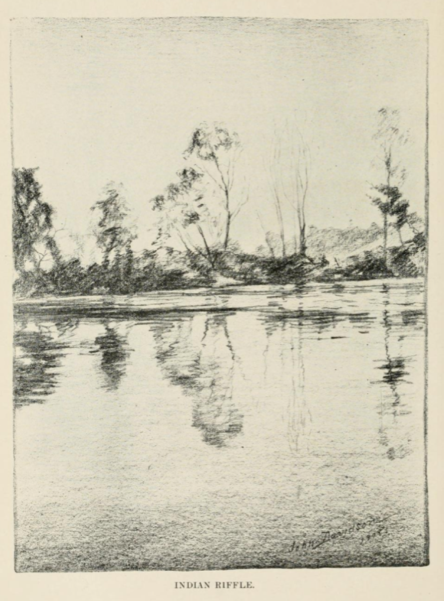
Parts of the old Indian Riffle road used to run alongside the Little Miami River, and the road now crosses the river at just one point. The river is key to explaining the second part of the road’s name: riffle/ripple. Rivers are made up primarily of two formations: riffles and runs. A riffle is a shallow area in which rocks break the water’s surface, while a run is a chute of fast water where rocks don’t reach the surface. The Little Miami River features many riffles and runs throughout its stretch in Greene County, but there’s an illustration captioned “The Indian Riffle” in a 1908 collection of writings on the history of the county—suggesting that one Greene County riffle in particular might have been the “Indian Riffle.”
What is now Indian Ripple Road began as an agricultural road frequented by horses sometime in the 19th century, and its route gradually shifted to accommodate the landowners of the time. Although the road appears on atlases going back to the mid-19th century, it wasn’t named until the turn of the 20th century and didn’t become a paved road until 1940. At the time, the traffic was still primarily local, agricultural traffic, and it didn’t seem to be used much by travelers as a thoroughfare. Most of the land along the road was owned by only a handful of people.
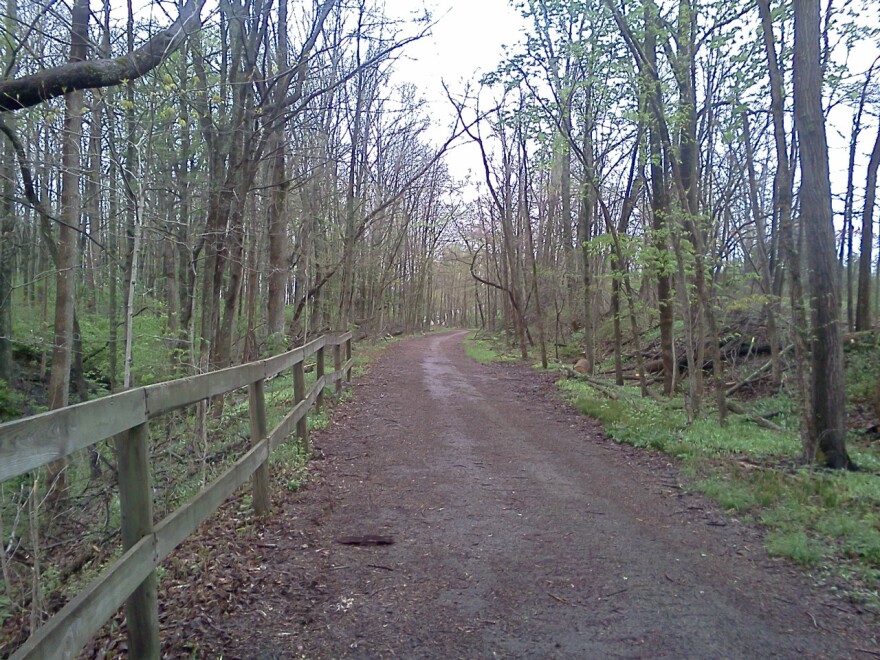
In the 1940s, the land along (what was then) Indian Riffle Road began to be split up and some residential development began in the area, though much of the stretch remained rural. An older portion of the road now makes up the Old Road Trail inside the Narrows Reserve along the Little Miami River.
Modern Development

A lot has changed since Indian Riffle’s days as a horse trail: The first commercial establishment showed up in the 1950s when Riffles Carryout opened. Residential and commercial development along Indian Riffle road continued, and in the late 1950s, the name was changed to Indian Ripple Road. Accessible records from that time don’t state precisely when or why the change occurred, but the shift is visible in residential listings from the US census.
In recent decades, the area has become increasingly hot for commercial activity. In 1986, Interstate 675 was completed through Beavercreek, which immediately made the area surrounding the Indian Ripple Road exit more attractive to developers. In 1994, the City of Beavercreek published the Indian Ripple Corridor Strategy, the result of a task force study of the community along the entire road. It explored issues such as transportation, recreation, land use and schools. One of the results of the study was that in 1999, Indian Ripple Road was partially re-routed to improve safety at the N. Fairfield Road intersection.
Beavercreek is one of the Miami Valley’s most affluent communities and remains an area of growth. The largest and most recent commercial development on Indian Ripple Road was the Greene Town Center, commonly known as the Greene, which was completed in 2006. Because of the Greene, the once-rural Indian Ripple Road is seeing more traffic now than ever.
WYSO Curious is our growing, changing series driven by your questions and curiosities about the Miami Valley. Is there something you’ve always wondered about the Miami Valley’s history, people, culture, economy, politics, or environment? Send in a question now, and check back to see which questions we’re considering.
WYSO Curious is a partner of WBEZ's Curious City,which was founded by Jennifer Brandel and is one of ten Localore productions brought to life by AIR.


