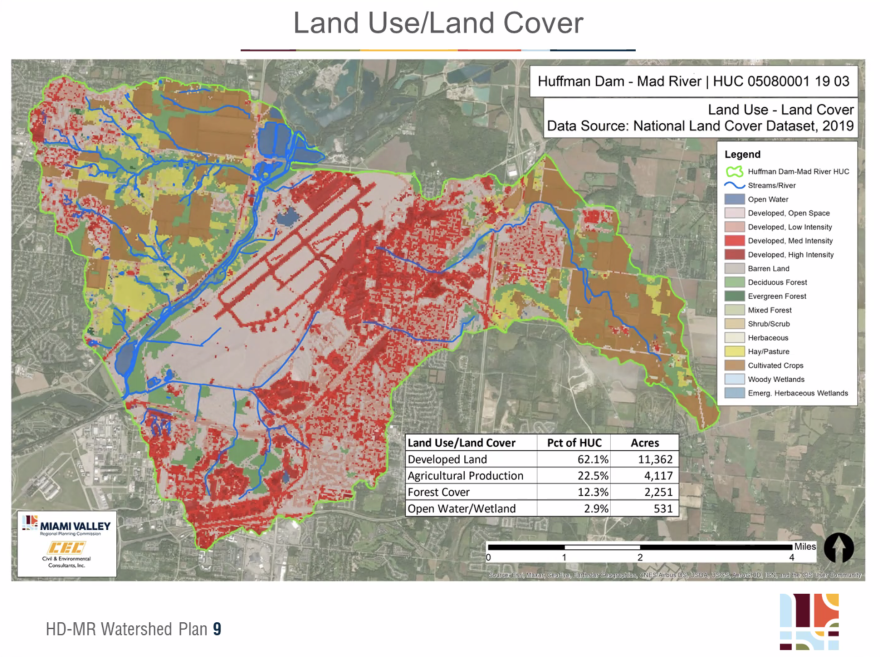
The Miami Valley Regional Planning Commission is developing a draft strategic plan for the Hebble Creek-Mad River watershed. The commission says the strategic plan will guide the local officials trying to figure out how to improve the watershed’s quality.
The Hebble Creek-Mad River watershed is a 28-square-mile area upstream of the Huffman Dam. More than 60% of the land in the watershed is developed and nearly another quarter is farmed.
These factors have caused excessive levels of nitrogen and phosphorus from the Hebble Creek-Mad River watershed to flow into the tributaries of the Ohio River, then the Mississippi River —and ultimately the Northern Gulf of Mexico.
Matt Lindsay, with the MVRPC, said the plan calls for restoring banks, floodplains, streams and wetlands to capture that nutrient runoff.
“The draft seeks to support Ohio's goals for reducing nitrogen and phosphorus in waterways by 20%, this is both from urban stormwater and from agricultural runoff, to contribute to reducing the Gulf of Mexico hypoxia zone,” Lindsay said during a virtual pub lic meeting Thursday, May 11. The meeting was attended only by journalists and a few other state employees.
Hypoxia, or dead zones, are areas of low oxygen that can harm fish and marine life. The dead zone in the Gulf of Mexico has been on average larger than the states of Delaware and Rhode Island combined over the past five years.
Lindsay said another evidence-based strategy that the draft strategic plan suggests for professionals to prevent nutrient runoff in the Hebble Creek-Mad River watershed is to focus efforts on areas with less tree cover.
“These areas are potential locations for stream restoration projects. Healthy vegetated buffers along streams can slow down and filter runoff before it reaches the waterway.” He said, “Trees can also provide shade to keep water temperatures cool.”
The public can comment on the strategic plan until Monday, May 22, 2023 by going to this link or by emailing Lindsay at mlindsay@mvrpc.org.
The plan will then need to be approved by the Ohio EPA.
Chris Welter is a reporter and corps member with Report for America, a national service program that places journalists in local newsrooms.

